Tony Two-Cent
Administrator
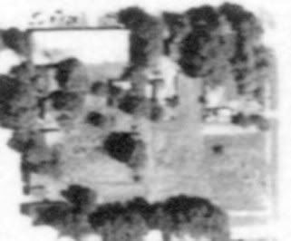
I want to create some side-by-side comparison photos of 1930s aerial photos next to current satellite images of potential hunting sites. I know how to find and save the 1930s aerial photos to my computer and edit them as needed.
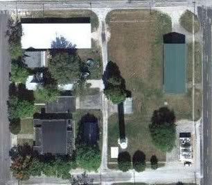
My question is, how do I save the current satellite images to my computer and edit them? When I go to Google maps and view the satellite images I can't find any way to save the images to my computer so I can open them in my image editing software.
Any hep would be appreciated! thumbsup01
My question is, how do I save the current satellite images to my computer and edit them? When I go to Google maps and view the satellite images I can't find any way to save the images to my computer so I can open them in my image editing software.
Any hep would be appreciated! thumbsup01
 , but HTH. Just shout if you have further questions, I do this stuff all the time.